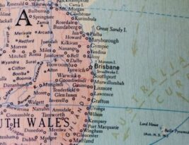
Historical maps provide invaluable insights into the past, revealing changing landscapes, borders, and urban developments. To preserve these significant documents and make them more accessible to a wider audience, converting them into digital formats has become …
Blog Posts
Manual map making requires a unique set of tools that are essential for creating accurate and detailed maps. Whether you are a cartographer, explorer, or simply enjoy creating maps as a hobby, having the right tools …
Field observations are a crucial aspect of various disciplines, including geography, geology, ecology, and urban planning. These observations often need to be translated into map sketches to accurately represent the data collected. However, this process can …
Creating digital maps has become an essential tool for various industries, from urban planning to marketing. With the advancement of technology, there are numerous software options available for digital map making. Choosing the right software can …
Creating a Detailed Visual Representation: How Are Elevation and Relief Represented on Maps? Maps are not just handy tools for navigation; they are intricate visual representations of the world around us. Every contour and symbol on …
Topographic maps are essential tools used by geographers, cartographers, hikers, and outdoor enthusiasts to understand the physical features of a particular area. They provide detailed information about the terrain, elevation, and topography of a region, helping …
Geospatial technologies have revolutionized the way we understand and interact with the world around us. From GPS navigation systems to geographic information systems (GIS), these tools have become essential in a wide range of industries, including …
In the world of modern technology, satellite images play a crucial role in creating detailed and accurate digital maps. These digital maps have become an integral part of our daily lives, aiding in navigation, urban planning, …
Understanding Contour Lines and Their Relationship to Elevation Have you ever looked at a map and noticed those curved lines that seem to crisscross the landscape? These lines are not mere decorations but are actually crucial …
Topography, the study of the shape and features of land surfaces, plays a crucial role in various fields such as geography, geology, and urban planning. While modern technology provides detailed maps and aerial imagery, capturing topography …
Topographic maps are essential tools used by geographers, hikers, planners, and various other professionals to understand and navigate different types of terrain. These maps provide a detailed representation of the earth's surface, showing elevation changes, landforms, …
Heading into the great outdoors for an adventure is an exhilarating experience, but it's crucial to have the right tools to navigate your way through nature's vast landscapes. A GPS device is an essential companion for …
Cartography is the art and science of mapmaking, essential for understanding geography, navigation, and spatial relationships. Maps have been used for centuries to represent the Earth's surface and provide valuable information to various fields. To create …
Embarking on a hiking adventure can be an exhilarating experience for outdoor enthusiasts, with the right trail map serving as an essential tool for ensuring a safe and enjoyable journey. Creating an effective hiking trail map …
Designing an Election Map That Reflects Voting Patterns Election maps play a crucial role in visually representing voting patterns and outcomes. They provide valuable insights into how votes are distributed geographically and help us understand the …
Mapping economic data is a powerful tool that allows us to visualize complex information in a clear and intuitive way. By representing economic indicators on a map, we can quickly identify patterns, trends, and disparities that …
Thematic maps are powerful tools for visualizing and analyzing demographic data. By effectively displaying spatial patterns and relationships within a dataset, thematic maps can help researchers, policymakers, and businesses make informed decisions. In this article, we …
In today's technologically advanced world, where GPS systems and satellite navigation dominate the field of navigation, one might wonder what role sextants, a tool from the past, play in modern-day navigation. Surprisingly, sextants still hold a …
In today's tech-savvy world, the age-old debate between paper maps and digital navigation tools continues to divide travelers and adventurers alike. Both options have their own set of advantages and disadvantages that cater to different preferences …
Thematic mapping is a powerful tool that helps to visually represent spatial data and convey complex information in a clear and accessible way. By using thematic mapping techniques, data can be transformed into compelling maps that …
