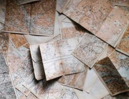
Venturing into the great outdoors and embarking on a hiking adventure can be an exhilarating experience for many outdoor enthusiasts. The fresh air, stunning views, and sense of accomplishment that come with conquering a challenging trail are unmatched. However, as with any outdoor activity, hiking comes with its own set of risks. From unpredictable weather conditions to difficult terrain, hikers must always be prepared for the unexpected. In recent years, the use of topographical guides has gained traction as a …
Topographic Guides
Understanding the intricate details of a topographic map can be an invaluable skill for adventurers, hikers, geographers, and outdoor enthusiasts. These maps provide a wealth of information about the terrain, elevation, and features of a specific …
Topographic maps are essential tools used by geographers, cartographers, hikers, and outdoor enthusiasts to understand the physical features of a particular area. They provide detailed information about the terrain, elevation, and topography of a region, helping …
Understanding Contour Lines and Their Relationship to Elevation Have you ever looked at a map and noticed those curved lines that seem to crisscross the landscape? These lines are not mere decorations but are actually crucial …
Topographic maps are essential tools used by geographers, hikers, planners, and various other professionals to understand and navigate different types of terrain. These maps provide a detailed representation of the earth's surface, showing elevation changes, landforms, …
Benchmarks play a vital role in the field of topography, providing essential reference points for surveyors and engineers to accurately measure and map the Earth's surface. These benchmarks act as fixed, stable points that allow for …
Topographic maps and compasses are essential tools for navigating through the wilderness, providing a reliable means of orienting yourself and finding your way in various terrains. Whether you are an avid hiker, a passionate camper, or …
Creating digital topographic maps requires a combination of specialized tools and software to accurately capture and represent the Earth's surface features. Topographic maps are essential for a variety of applications, including urban planning, natural resource management, …
Topographic maps are essential tools used by geographers, cartographers, hikers, and many others to understand and navigate the Earth's surface. These maps provide detailed information about the terrain, including elevation changes, landforms, and natural features. One …
Navigating the outdoors can be an exhilarating experience, but it requires a good understanding of topographic maps to ensure a safe and successful journey. Topographic maps are detailed representations of a terrain's surface features, such as …


