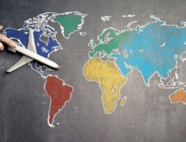
Tracking the spread of diseases has always been a critical aspect of public health management. As the world faces the challenge of controlling the spread of contagious illnesses like COVID-19, the use of thematic maps has emerged as a valuable tool in monitoring and understanding the dynamics of disease transmission. Thematic maps, which represent spatial data through visual elements such as colors and patterns, offer a unique perspective on the geographical distribution of diseases. But can thematic maps truly be …
Thematic Mapping
Mental Maps and Their Relationship to Thematic Mapping When we think about the concept of maps, the image that often comes to mind is that of physical maps, depicting geographical locations and topographical features. However, there …
Designing an Election Map That Reflects Voting Patterns Election maps play a crucial role in visually representing voting patterns and outcomes. They provide valuable insights into how votes are distributed geographically and help us understand the …
Mapping economic data is a powerful tool that allows us to visualize complex information in a clear and intuitive way. By representing economic indicators on a map, we can quickly identify patterns, trends, and disparities that …
Thematic mapping is a powerful tool that helps to visually represent spatial data and convey complex information in a clear and accessible way. By using thematic mapping techniques, data can be transformed into compelling maps that …
Color schemes play a crucial role in the design and interpretation of maps. They help convey information effectively, differentiate between various map elements, and enhance overall visual appeal. When it comes to selecting color schemes for …
Climate maps are an essential tool for understanding and visualizing the complex patterns of climate across the globe. By using a combination of data sources and visualization techniques, climate maps provide valuable insights into temperature, precipitation, …
Cultural landscapes are a reflection of the interactions between human societies and the environment over time. They encompass a wide range of physical and intangible elements, including buildings, monuments, traditions, and beliefs. Mapping cultural landscapes is …
Population density maps are powerful tools that provide valuable insights into the distribution of people in a given area. By visualizing population density, researchers, urban planners, and policymakers can make informed decisions regarding resource allocation, infrastructure …


